DOTS
Fleet Monitoring and Automation Software
Domestic production of modern and reliable equipment.
Guarantee
36 months
Accuracy
up to 0.05%
Number of reports
No restrictions
Developer
Russia, Karelia

Our systems are included in the register of Russian software and have a certificate of conformity from the Russian Classification Society.
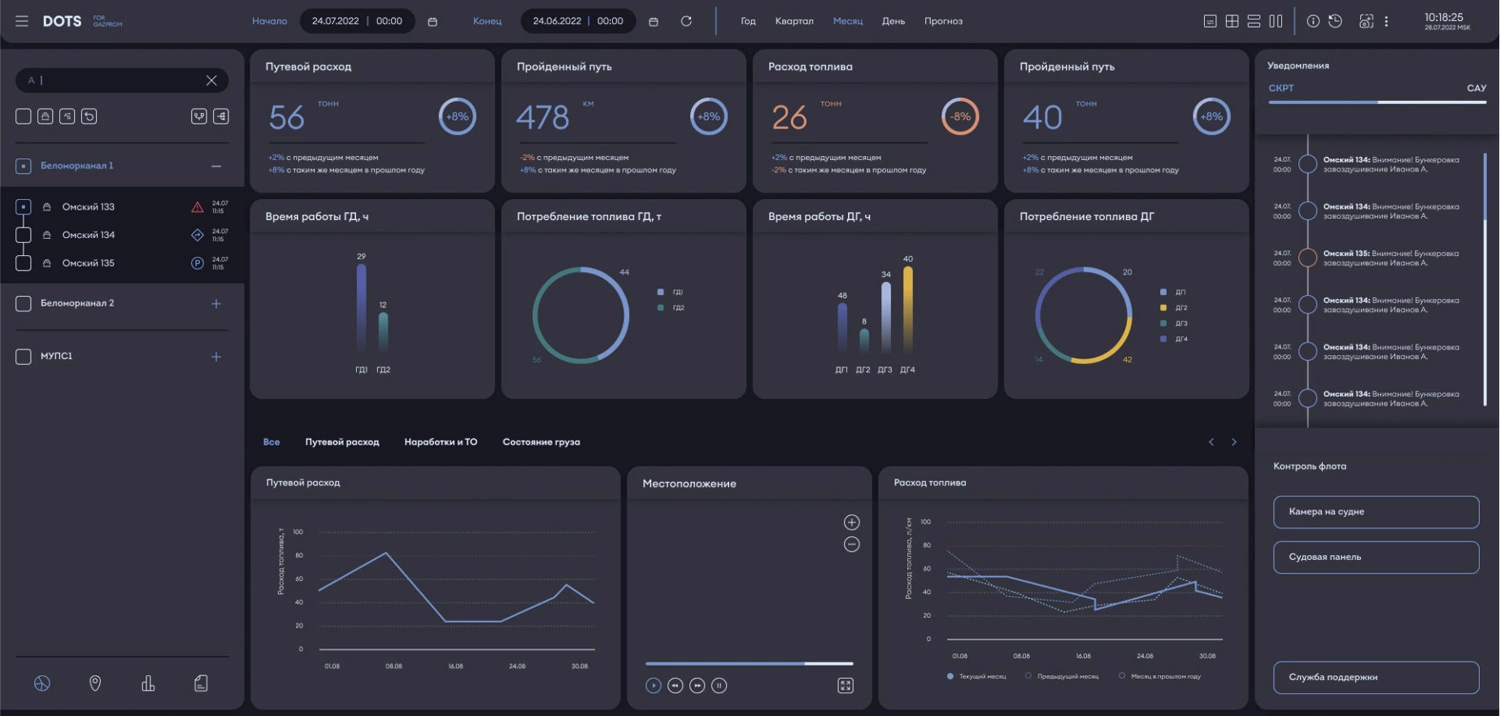
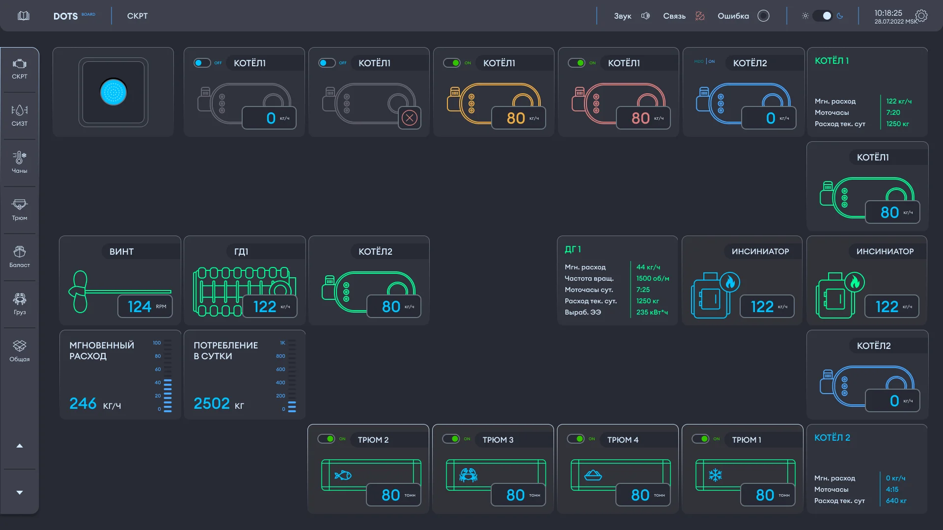
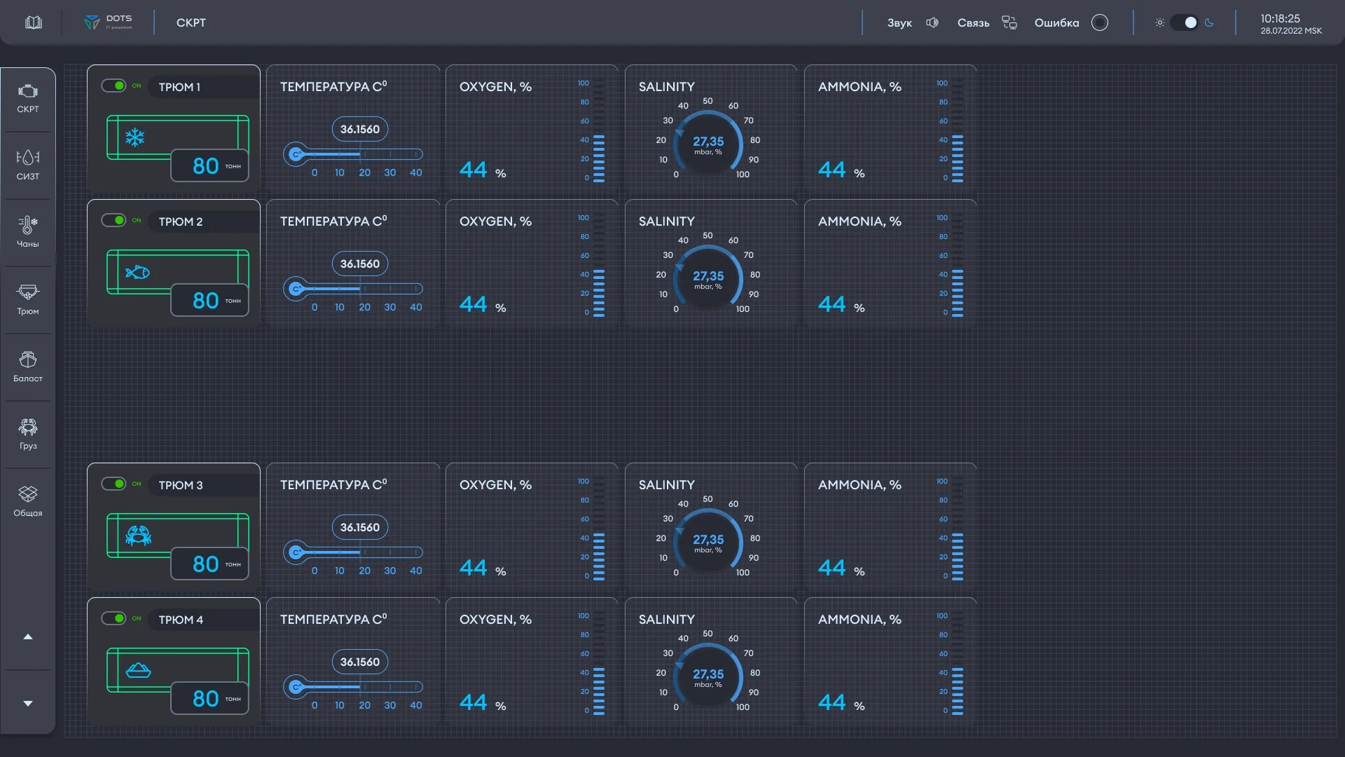
The DOTS hardware and software system is designed to collect, analyze, and visualize data from remote devices and objects in real time, with detailed information on each object.
Стек технологий


The system displays the coordinates, speed, direction of movement, and operating mode of the monitored object, providing access to the collected data anywhere and at any time via the Internet.
Capabilities of
the DOTS hardware and software system
The DOTS system allows for a comprehensive analysis of an object’s activity: with detail ranging from a few seconds to several years, both the functioning of the object as a whole and of its individual units.
Access to collected data anywhere and anytime via the Internet
Displaying a vessel on an electronic chart in real time
Presentation of vessel activity data for any period of time in the form of tracks, reports, and graphs, with the ability to print and export to a convenient format (xls, pdf, etc.)
Possibility of creating geofences for observation objects
Timely notification of important events (deviation from the route, exit from the geofence, change of parameters)
Weather map support
Displaying information about the vessel's operation using the graphical SCADA interface
Flexible customization of program functionality to meet user requirements
Transfer of data to management and accounting systems used at the enterprise (1C, Parus, etc.)
Differentiation of access rights of user categories to data
Request a demonstration of our system's capabilities and experience the convenience of our developments!
Request a demoEven MORE
possibilities with DOTS
Analytics
and data display
-
Name
-
Coordinates
-
Speed
-
Direction of movement
-
Operating mode
-
Nearest address
Working
with geofences
-
Ability to export geofences from various sources
-
The ability to “draw” a geofence in the system
-
The ability to use geofences in the track and graphics, DOTS multitrack, visualizing monitoring objects

Building
reports
-
Shift reports
-
Reports on benchmarks (geofences)
-
Bunkering reports
-
Daily, monthly and final reports

Receiving
notifications
-
Via email
-
In the Telegram channel (Telegram bot)
From vessels of the situation and transport fleet to floating equipment for technical marine processes (dredgers, drilling rigs, floating bases).
Try our system in action
Sign up for an online demonstration of the system
Let's show you how the system works using REAL objects as an example!
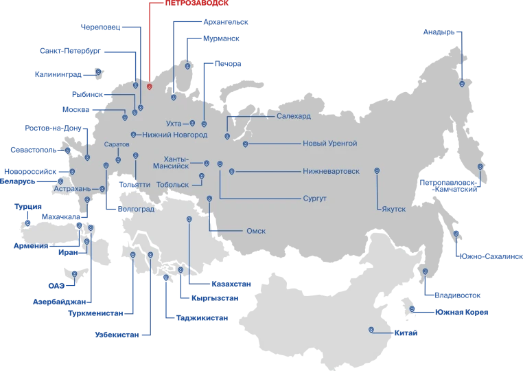
Trusted by industry leaders


WE WORK WITH CLIENTS ALL OVER THE WORLD
We'll tell you in more detail how we ensure uninterrupted operation of systems